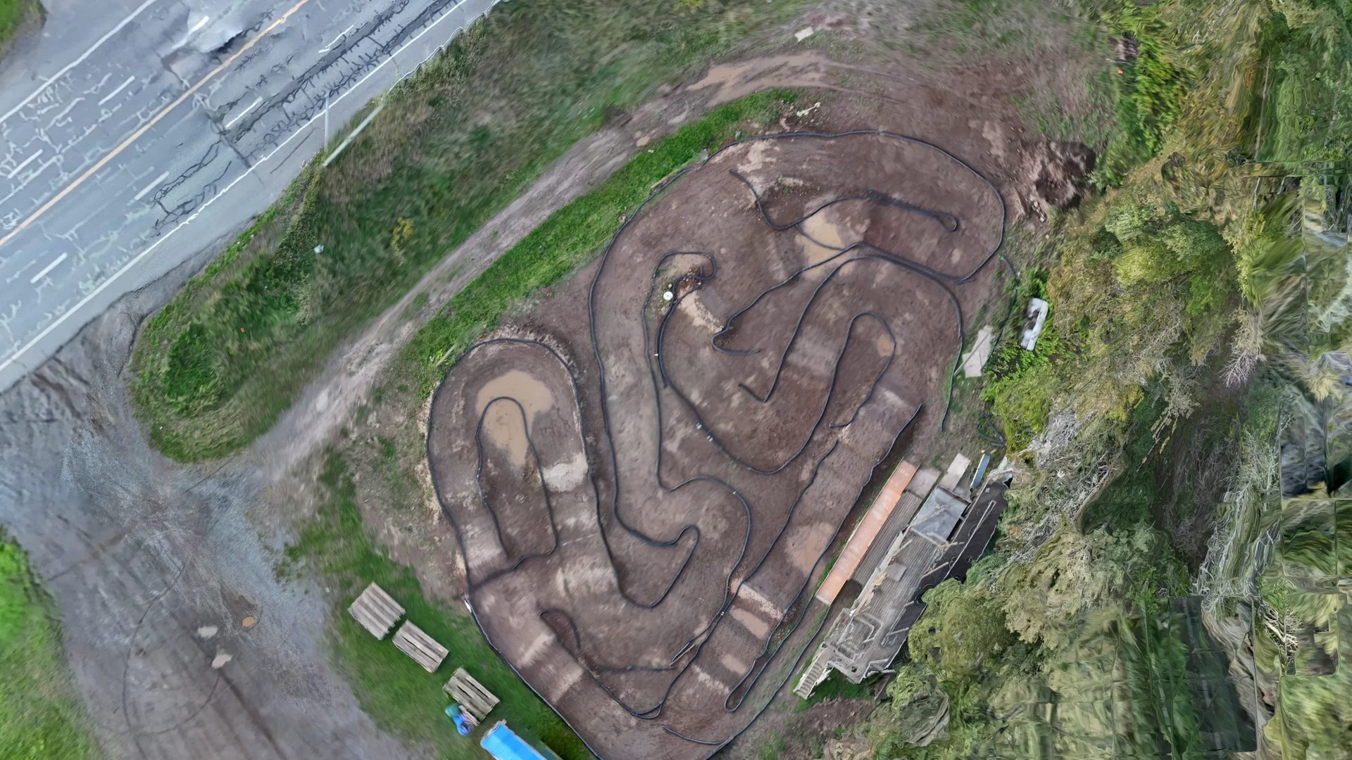
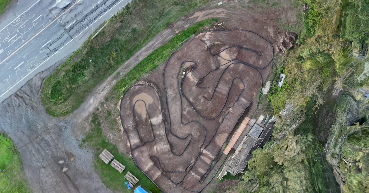
LRCCC Speedway orthomosaic, Thunder Bay, flown 2026-09-15 at 1.00 cm ground sample distance: the dirt track, the paddock and the edge of the highway seen straight down

Orthomosaics and 3D terrain, flown from Thunder Bay, delivered in days.

Visualisation-grade today (GNSS-positioned, no ground control); survey-grade with your GCPs or a licensed surveyor’s checkpoints.

LRCCC Speedway, Thunder Bay · ground sample distance (pixel size) 1.00 cm · flown 2026-09-15 · GNSS-positioned, visualisation grade

Who it is for

Three kinds of ground, one way of working

Small aircraft that travel in a pack, photos processed on my own hardware, maps delivered in the formats your GIS already reads.

Mineral exploration

A current, georeferenced picture of the claim block for trenching, outcrop mapping, access and camp planning — before the crew leaves site.

Deliverables: orthomosaic GeoTIFF · DSM · GeoPackage · Avenza-ready georeferenced PDF · 3D mesh

Drone mapping that supports geological mapping and reporting can be an eligible contractor cost under the Ontario Junior Exploration Program (50 % of eligible costs, to $200,000 per project for juniors, $50,000 for prospectors). Ask me for a quote formatted for your OJEP budget. Program guidelines (PDF).

Forestry and silviculture

Cutblock and planting layout, regeneration and brushing records, road and landing condition — a map the crew carries on a phone, offline.

Deliverables: orthomosaic GeoTIFF · GeoPackage · Avenza-ready PDF · QField project for field data collection

Camps and utility right-of-way

Camp and access planning, progress records, and a 3D flythrough that explains a site to someone who has never stood on it.

Deliverables: orthomosaic · DSM · textured mesh · flythrough video · web map

Work

Two jobs, shown in full

Every image on this site is from a flight I flew. Each case study carries its own numbers and its own caveats.

19 min

Sixty photos to a 1 cm map in nineteen minutes, on my own hardware

LRCCC Speedway, Thunder Bay. Flown by hand at dusk when the planned mission would not run; processed the same night, 60 of 60 photos reconstructed at 0.87 px mean reprojection error.

Read the LRCCC case study →
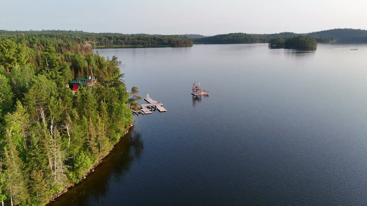
Cuttle Lake Resort camp, a frame from the 3D flythrough rendered from the 2026-07-10 orthomosaic and mesh
7.4 ha

A resort mapped end to end: flown, processed, published, and collecting data from the owner’s phone

Cuttle Lake Resort. Two flights, a 4.2 cm orthomosaic, a 2 m DSM, a cinematic flythrough, and a password-protected web map with a data-collection loop the owner runs himself.

Read the Cuttle Lake case study →

Explore the LRCCC orthomosaic

Poster for the LRCCC Speedway orthomosaic map viewer

Zoom 15 to 23. Tiles load as you pan; a full look is a few hundred KB.

LRCCC Speedway, Thunder Bay · ground sample distance (pixel size) 1.00 cm · flown 2026-09-15 · GNSS-positioned, visualisation grade · no basemap: the map is the orthomosaic and nothing else

3D

Turn the site in your hand

Textured meshes of both sites, built from the same photos as the maps and viewable on a phone. Nothing downloads until you open one — the models are 9 and 13 MB.

Open the 3D page
Poster for the LRCCC Speedway 3D model: the orthomosaic that also textures the mesh

LRCCC Speedway mesh · 633,872 vertices · textured from the 1.00 cm orthomosaic · flown 2026-09-15 · GNSS-positioned, visualisation grade

Services

Three offers, in the order most people need them

1. Orthomosaic and site plan

A georeferenced, current aerial map of the site at 1–5 cm ground sample distance, measured in your GIS or carried on a phone.

Formats: GeoTIFF · GeoPackage · Avenza-ready georeferenced PDF · web map tiles

2. Elevation and 3D

Digital surface model, point cloud and textured mesh from the same flight — for drainage, access and camp planning, and for showing a site to someone who cannot get there.

Formats: DSM GeoTIFF · point cloud LAZ · mesh GLB / OBJ · flythrough MP4

3. Field map and data collection

The map on the crew’s phones, offline, with forms that write back to a GeoPackage — sample sites, building details, planting quality, whatever the job needs recorded.

Formats: QField / QFieldCloud project · GeoPackage · password-protected web page

Accuracy, stated plainly. Every map is positioned by the aircraft’s own GNSS (PPK-corrected where the aircraft supports it). That gives excellent relative accuracy — distances, areas and heights within one map are consistent to a few centimetres at a 2-3 cm ground sample distance — and absolute positioning typically within 1-3 m of true ground for GPS-only flights, better with PPK. It is visualisation- and planning-grade: suitable for claim-block reconnaissance, trenching and outcrop mapping, cutblock and planting layout, camp and access planning, and progress records. It is not a legal survey and is not a substitute for a licensed Ontario Land Surveyor. When you need survey-grade absolute accuracy, I fly with your ground control or a surveyor’s checkpoints and deliver an RMSE report against them.

How it works

KMZ in, map out

Send the block

Email a KMZ, a shapefile, or a pin and a rough area. I come back with a flight plan, the ground sample distance it gives, and a quote — formatted for an OJEP budget if you need it.

Flight window

A small site is a single flight. I plan against NAV Drone airspace and the weather, and fly from the ground you already have access to — truck-in, boat-in or fly-in.

Processing and delivery

Photos are processed on my own hardware in Thunder Bay; nothing goes to a cloud service and your data stays in Canada. The LRCCC map went from landing to finished products in nineteen minutes of processing; the delivery window for your site is confirmed with the quote.

TODO: operator_photo
Ted Gilverson in the field with the aircraft.

About

Ted Gilverson

Owner-operated. I plan the flight, fly it, process it and build the map — no subcontractors, no cloud processing. Based in Thunder Bay. Day trips across Northwestern Ontario; overnight, fly-in and boat-in work along the Wawa and Red Lake corridors.

By day I manage forestry and right-of-way crews across Northwestern Ontario. The mapping came out of that work: a crew with a current map on their phones makes better calls than a crew with a screenshot.

  • Sub-250 g aircraft operating under Transport Canada’s microdrone rules.
  • Safety: Every flight is planned against NAV Drone airspace, pre-flight checked and site-briefed before the aircraft leaves the case.
  • Processing: on my own hardware in Thunder Bay — your data stays in Canada.

Contact

Send me a KMZ

The fastest honest quote input is the outline of the block. Attach it to an email with where it is, roughly how big, and when — I reply with a plan and a price.

Email
ted@licketysplitconstruction.ca
Base
Thunder Bay, Ontario

Send me a KMZ

Opens your mail app with the subject and the questions filled in. Attach the KMZ before you send.

What to include

  • Site location — a KMZ, a shapefile, or a pin
  • Approximate area in hectares
  • When it needs flying, and when the data is needed
  • What you need: orthomosaic, elevation, 3D, a field map, or all of it
  • Whether you have ground control or a surveyor’s checkpoints on site